
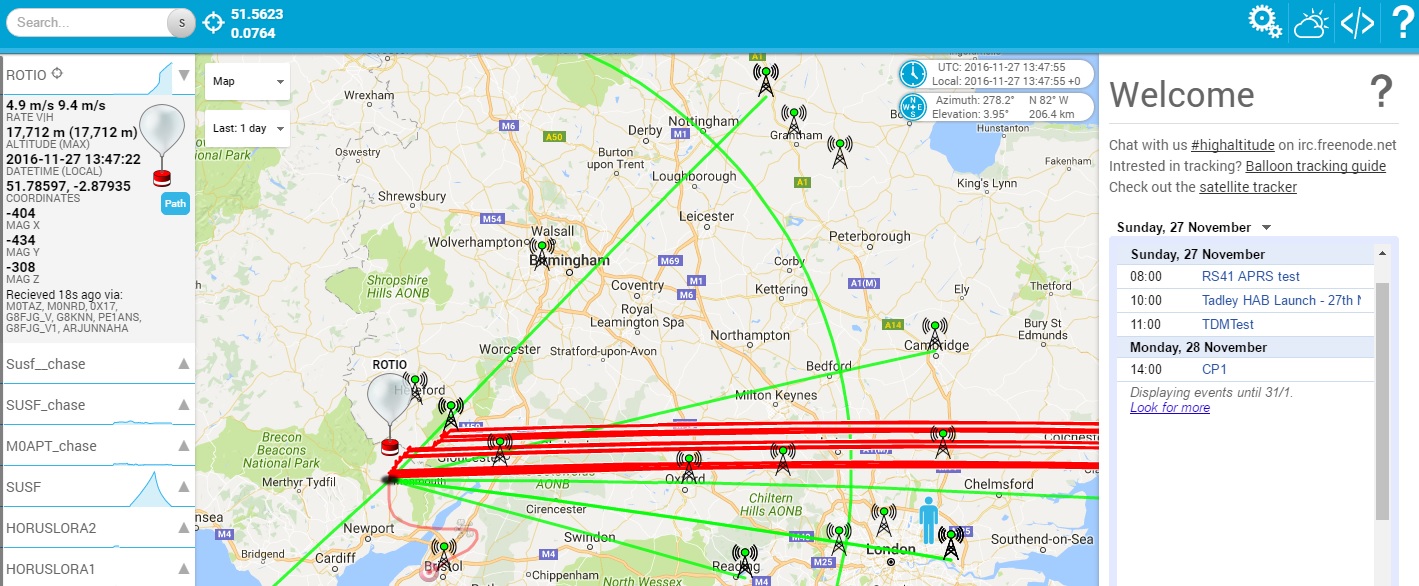
Amateurs often launch HAB containing telemetry and sometimes SSTV of the ability to take and store pictures. The launch schedule is usually published online, its worth starting with this online resource. Tracking is based on an adapted version of FLdigi, this program once configured with your callsign and location will manage the upload to a central server.
UKHAS have published a beginner’s guide to HAB in the UK
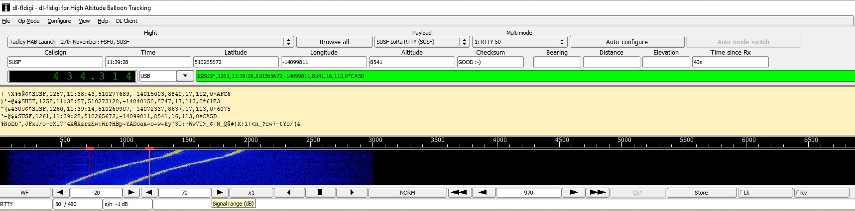
You select the balloon you wish to receive and the program will configure the mode and frequency (requires CAT)
Here is an example of the data sent, the packet includes Launch name, packet number,time,location,altitude,satellites and a checksum.
SUSF,1359,11:56:28,509771791,-15067697,2594,18,140,0*C750
Its quite incredible to think you can often receive these balloons at 800 miles or more when they transmit as little as 10mW. I guess it helps if your antenna is 30 Km about the earth.
 You will notice on this decode the frequency is drifting a little, probably due to the extreme temperature experienced by the transmitter. Your data will be combined with other stations, and the location of the HAB will be displayed on a map.
This is ROTIO, you can see it has some issues with GPS lock….
Frequency stability can sometime be an issue.
Unfortunately things dont always go to plan, sometimes the conditions are just too harsh or something fails and the telemetry stops.