In previous articles I have discussed receiving aircraft position data Automatic Dependent Surveillance – Broadcast (ADS–B).
You can read about 1090 MHz antenna and ADS reception here.
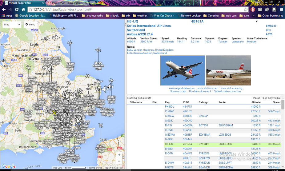
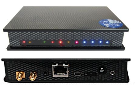
As the HF bands have been so poor recently I decided to try out Virtual Radar, and open source program that can visualise aircraft locations on a Google style map. The program can be used with a number of receivers including RTL SDR, but I opted to press into service the rather old Kinetics SBS1. The SBS1 is a dedicated 1090 MHz receiver, USB powered so no external supply required.
You can often pick these up second hand for around £100 on eBay and the receiver sensitivity seems very good. The program is free to download from their website and simple to setup, I used it with Windows 10 and it was simple to setup, running in a few minutes.
I configured the program to take its location data from Kinetic SBS-1 Base station program. This does provide some basic location and trail information, but to fully appreciate the data it really needs presenting in Google maps.
Coupled with a 5/8 wave antenna in a poor UHF urban environment I was able to achieve reception ranges of 150 miles. This could be further improved with a Low Noise Amplifier (LNA), band pass filtering and better positioning of the antenna. Virtual Radar can be configured to provide local and internet access to your aircraft data, letting people from around the worlds access your data. Virtual Radar also has the option to aggregate flight data to build up a picture of your reception radius. The data can be presented based on the altitude of the aircraft.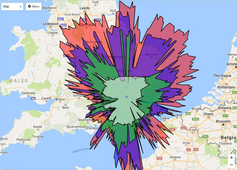
This option can be a little hard to locate in the software. You need to ensure you have a receiver location defined menu Tools/Options/receiver location and then you must have that location selected under Receivers, look for the box “Location” and then select the name you gave your receiver from the previous steps.
Once this is complete a new option will be available from the aircraft browser map, click on Menu, and look for receiver range. If you don’t have this menu option, then one of the previous steps may be incorrect. You also can’t access receiver range by default from a remote connection, this has to be enabled. You will find some further guidance on the virtual radar forum.
Virtual radar will if connected to the internet display other details about selected flights, routing information and pictures of the aircraft type.
Virtual Radar Server is an open-source .NET application that runs a local web server, and full credit goes to the development team.